Explore medieval life and death with these 5 brilliant interactive maps!
Travels, murders, and......eels?!!
Normal map, France, 16th century
For most of their existence, original sources and records from the Middle Ages sat in libraries and private collections, largely unavailable to the public. But today, thanks to modern technology, they’re easier to access than ever: the information, manuscripts, and resources that have been transcribed, translated, digitised, and put online are far more than you could ever hope to use in your life! It’s exciting, but also a little bit intimidating, and definitely hard to know where to start. In order to help you make the most of your historically-unprecedented privilege, I’ve put together a list of five interactive maps that are easy to use and packed with interesting, enlightening, and occasionally very funny information about the medieval world.
Enjoy!
NB: England is slightly overrepresented here because it is a list of English-language resources, but if you’ve got any other great maps or websites that weren’t mentioned in this list, please do leave a comment so everyone can enjoy those, too!
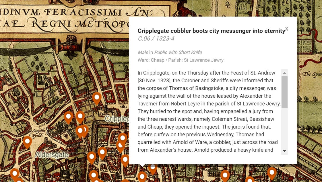
1. London Medieval Murder Map
By the Violence Research Centre at University of Cambridge.
The punny headlines are a modern addition but a very welcome one.
Thanks to the late medieval London coroner's rolls, we have access to records of hundreds of centuries-old homicides in vivid (often painfully vivid) detail. This map shows the historic streets of 15th-century London overlaid with the locations and details of murders that took place there. Its makers note that it's not a comprehensive view of medieval crime and caution against using it to draw conclusions about the nature of life in the Middle Ages, but it's still a fascinating resource. Have a look through and you'll find out about the dangers of things that may seem harmless or even commonplace today, such as leaving your baby unattended when pigs are nearby or dropping your leftover eel skins on the ground in front of someone else's shop.
If you like funny historical deaths, see also: London’s weekly death statistics during the Great Plague of 1665.
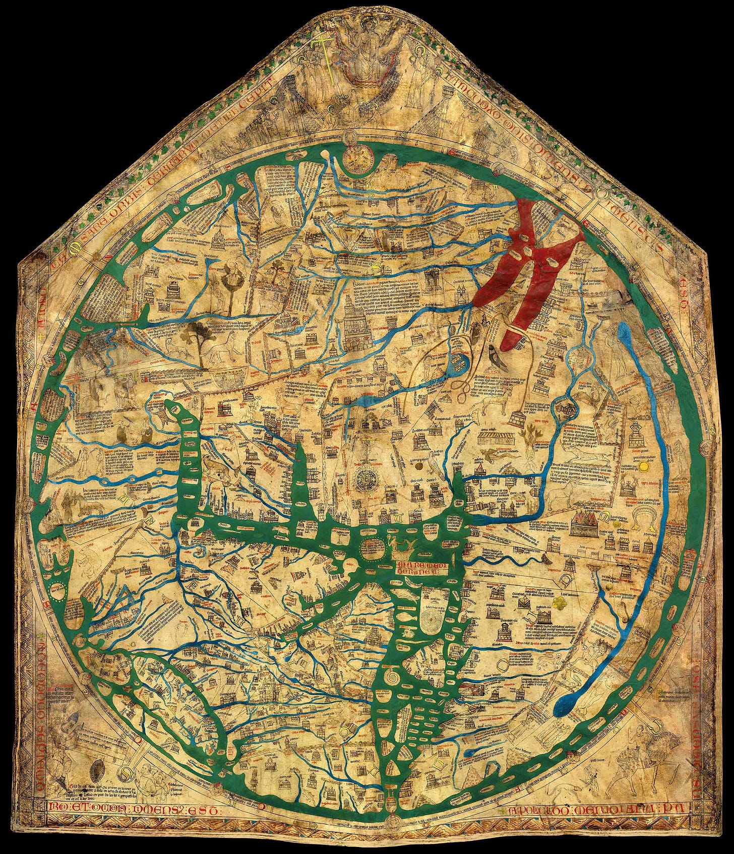
2. The Hereford Mappa Mundi
By Virtual Mappa
Before the magnetic compass was adopted as a tool of navigation, maps were rarely used as way-finding tools on long voyages. Many medieval maps, particularly early ones, were therefore less concerned with topographical details than with cultural and religious knowledege. Such maps present the known continents as sectors of a circle, with biblical scenes and mythological beings inhabiting them alongside real-world features and settlements. One such creation, the Hereford Mappa Mundi from ca. 1300 AD, is the largest extant Medieval map (the Ebstorf Mappa Mundi, which was almost triple the size, was destroyed by the Second World War). It is available to view online in gorgeous high resolution via the Virtual Mappa Project, whose website provides over 1,000 translations and annotations of the original Latin names and labels.
The Hereford Mappa Mundi may appear bafflingly naïve to those unfamiliar with medieval cartographic tradition: a unicorn prances on the banks of the Nile, the monsters Scylla and Charybdis of Homeric legend guard the waters between Sicily and Italy, and a large Christ in Majesty reigns over the whole thing. But it's a map of not only the physical but the mental and spiritual world, and a unique chance to assume the perspective of someone in England 700 years ago.
If you like medieval cartography, see also: Hereford Cathedral’s 3D scans and history of the map.
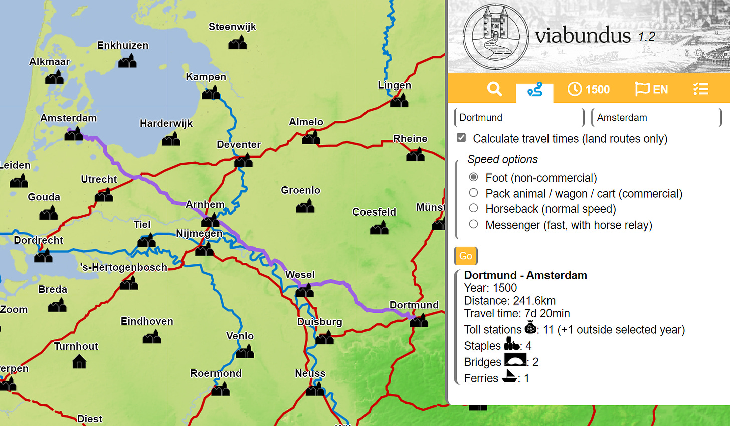
3. Medieval Google Maps (Viabundus)
Collaborative project hosted by the University of Göttingen
Presumably, annoying foreign tourists in Amsterdam were less of an issue back then.
Before Ryanair flights to Ibiza were £20, European travellers had to plan their routes a little more carefully. Even neighbouring cities could take a full day or more to reach on foot or horseback, and the spaces between were often empty and inhospitable. Though today we take our privilege of safe and speedy travel for granted, the project Viabundus helps restore a sense of the medieval world's scale with its interactive route finder and journey time estimator. Choose from any of close to 1,000 settlements in Northern and Central Europe to view a timeline of its history, population, and notable features, or open up the route planner to find out how long it would take you to get there from another location. In addition to the duration of your journey, Viabundus will tell you about the places you'll pass through in transit, the amenities available along the way, and all sorts of other fun details.
If you like medieval travelling and exploration, see also: this interactive map of John Mandeville’s 14th century travel writing.
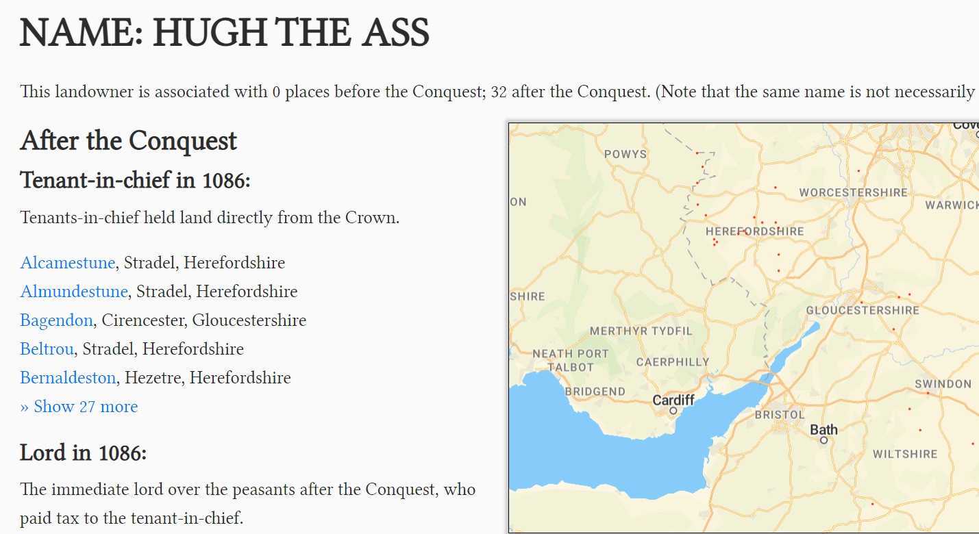
4. The Domesday Book
Imagine you pay rent to someone named “Hugh the Ass”…
William the Conqueror is best remembered for his, well, conquests — in particular, that of England in the 11th century, which permanently altered the course of the country's history and culture. Perhaps less glamorous but equally important were his contributions to record-keeping in the form of the Domesday Book, the first ever national census of England and its landholdings. Open Domesday maps the Book's findings, including its residents and their property before and after the Conquest, making this historically significant work more accessible than ever. Clicking through provides great insight into how the distribution of wealth changed during the Conquest as the Anglo-Saxon elites were deposed and replaced with Norman aristocrats, and it's also an amazing resource if you want some goofy and/or unique historical names: the people surveyed include Ælfric the Pig, Humphrey Goldenbollocks, Bordin of Thorpland, Gundwin the granary-keeper, and many more.
If you like silly names from the Middle Ages, see also: this paper that contains a list of over 1,000 dog names from the 15th century.
5. The Medieval Eel Economy
By Dr John Wyatt Greenlee, PhD
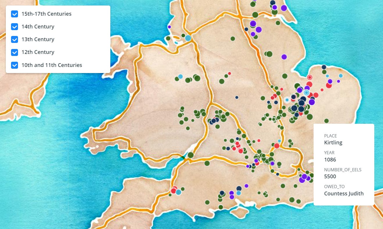
The European eel (Anguilla anguilla) has largely fallen out of favour in its home continent as a culinary fish, a trend that began even before its numbers shrank to historic lows in the past half-century. Today, many Europeans have probably never tasted eel in their lives. Until recently, though, the story was a bit different. Prized for their flavour (they are seriously delicious) and exploited for their abundance, eels were a staple food and a cornerstone of the European economy. A testament to their social and economic sway is the use of eels as a de facto currency in medieval England, where they were used in the hundreds of thousands to pay for rent, taxes, and other transactions. Greenlee's eel rent map collates records from 7 centuries of eel rent history, allowing users to explore the value of different landholdings expressed in numbers of these slippery, slimy fish.
If you like all things eel related, see also: Dr John Wyatt Greenlee’s Twitter for loads more medieval eel history and fun!



Also check out the Gough Map, c.1360 http://www.goughmap.org/map/
Let's play eel payment top trumps. Somebody made a payment of 1520 eels in my hometown, can anybody beat that?